Satellite artwork · Generative imagery
Satellite Image Exchange: The Terminal Vision
Synthetic satellite views of the Earth, generated from our own photographs and their metadata, and played back from orbit on the screen of an art satellite.
The Terminal Vision displays a series of moving images of the Earth on the screen of SCA*, as if the satellite were documenting what it sees as it drifts across low Earth orbit: city ruins, floods, oil spills; temple labs, empty bunkers, a man chopping trees, future resort cities.
None of it is real satellite data. Each landscape is synthesized from an archive of photographs we took ourselves. Rather than acquiring data, the "art satellite" becomes an emissive platform, projecting terrain generated by systems designed to reproduce, extract and simulate. The images carry the gaze of every visual machine they descend from — aerial photography, remote sensing, drone footage, phone cameras and generative models — and are at once imagined and the most realistic picture of a planet seen by humans and machines together.
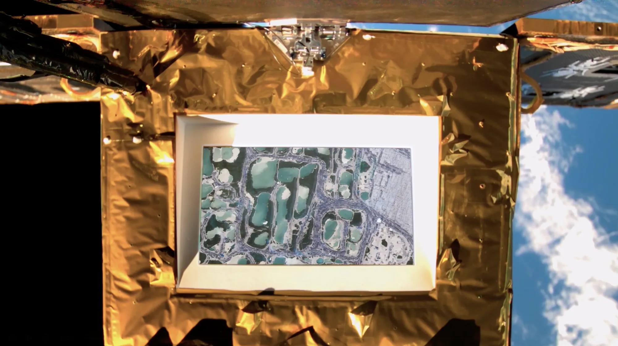
From horizontal photographs to vertical imagery
- Metadata. Each photograph's capture time and coordinates — the same data used to schedule communication with a satellite — locate it in time and space.
- Map tiles. The coordinates select the matching OpenStreetMap tile, which becomes the geographic base for the generated view.
- Labels. We write our own classifications for each photograph — "Heavy Machinery Ocean Resort Capitalism", "Lonely Single House Post Oceans" — mimicking, and redirecting, the labelling done by monitoring agencies.
- Generation. Labels and tiles condition GeoSynth (Sastry et al., EARTHVISION 2024), an open-source suite of ControlNet adapters for Stable Diffusion that generates high-resolution satellite images from OpenStreetMap tiles. Selected stills are extended into short orbital sequences with Runway Gen-4.
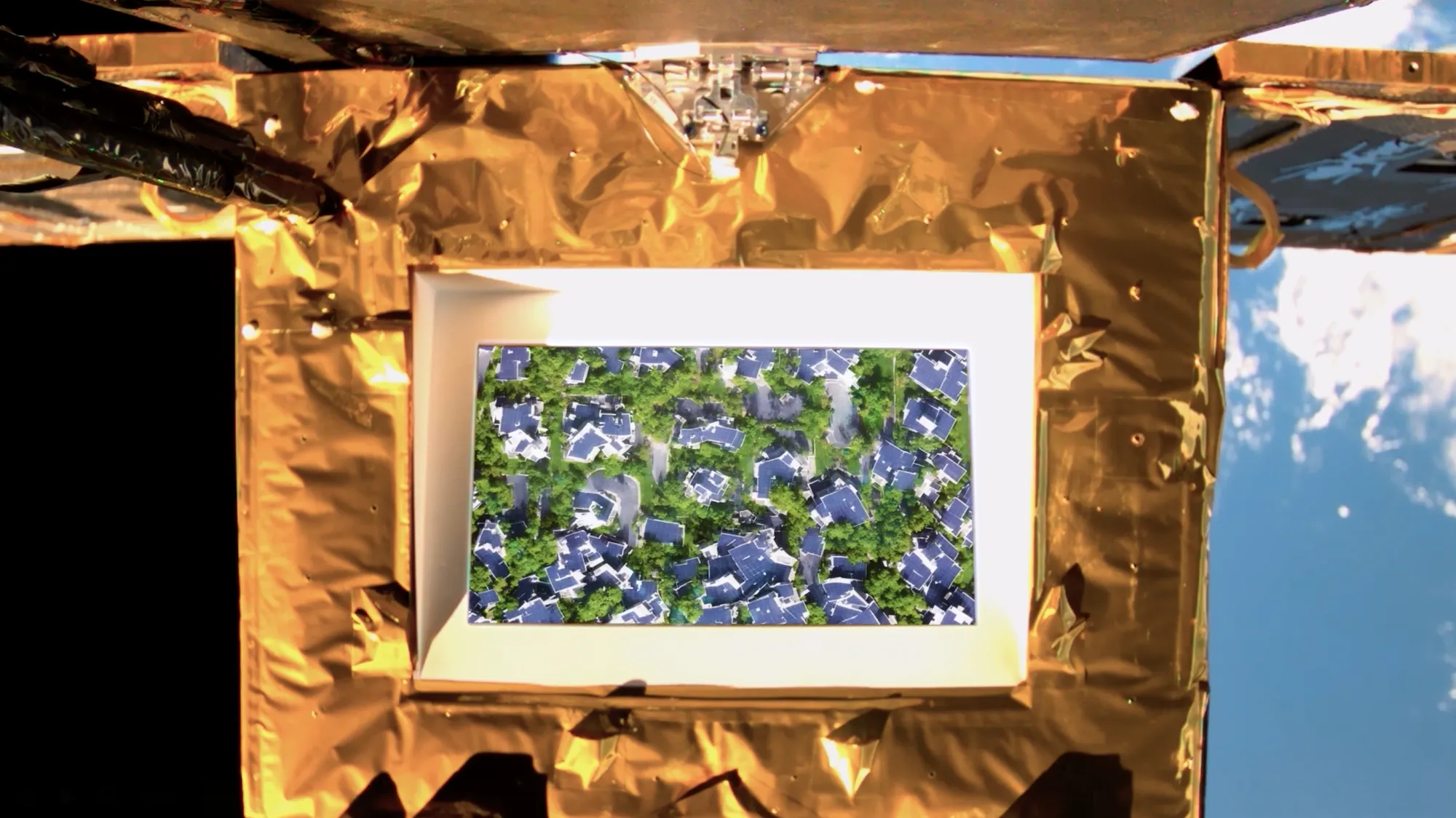
An exchange
This is the first of three phases. The project's longer aim is an observation protocol that invites anyone to share and exchange their own images, building an evolving body of satellite imagery that is public to all — imagery normally captured and controlled by governments and institutions. What is the world you would like us to see? Each contribution reflects its author's geopolitical position and infrastructure.
Developed through the Star Chain of Arts Project as part of the Xu Bing Space Art Residency. Broadcast photographed by SCA* via the Star Screen Photography Center, Mauritius (subsatellite point −17.188°, 58.903°). The title nods to J. G. Ballard's The Terminal Beach.